

RS-Geo Case Studies
Case Study - Multidisciplinary Topographic & Interior Survey
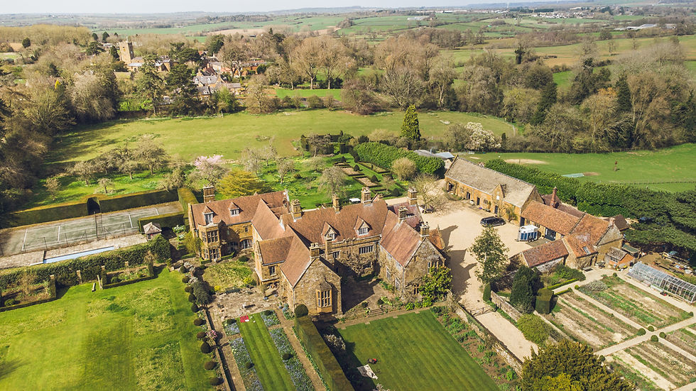
Geo-4D performed a detailed survey of the interior, exterior and grounds of a Manor House in Oxfordshire, collecting terrestrial laser scan data, aerial photogrammetry and ground penetrating radar to acquired a comprehensive dataset from which to derive detailed drawings.
Aerial imagery was processed photogrammetrically to derive an orthomosaic and high-density point cloud, which was cleaned and further processed to produce a digital terrain model (DTM).
These products were used to interpret and derive a topographic map of the site, including its natural and manmade features. In addition, geophysical data allowed for subsurface features to be superimposed on these maps.
Using the point cloud visualisation software, Nubigon, laser scan data from the interior of the house was used to derive ceiling, wall and floor plans, as well as interior orthomosaic scans. All data was provided to the Client in both pdf and CAD format.
Data Processing & Outputs


Our WingtraOne fixed aircraft was flown on an autonomous mission to collect ultra-high-resolution data and aerial imagery over the wider site.
An additional flight was conducted with the DJI mini 2 Pro, flown manually at close proximity to the manor’s walls and roof to capture it’s exterior at a greater resolution. This was also deployed outside to capture the ground elevation data in the vegetated areas not picked up in aerial images.
In order to map subsurface utilities such as power cables, telecoms and pipes, a cable avoidance tool (CAT), signal generator (genny) and ground penetrating radar (GPR) were also deployed.
Survey
Our Sister-Sites

Geo-4D is the sister company of RS-Geo, specialising in advanced geospatial analysis and 4D data integration. Together, we deliver end-to-end geoscience solutions.
.png)